NL
NL  IT
IT  DE
DE  ES
ES  EN
EN 
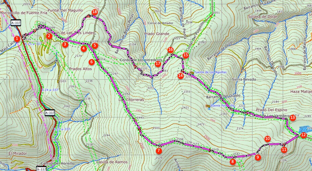
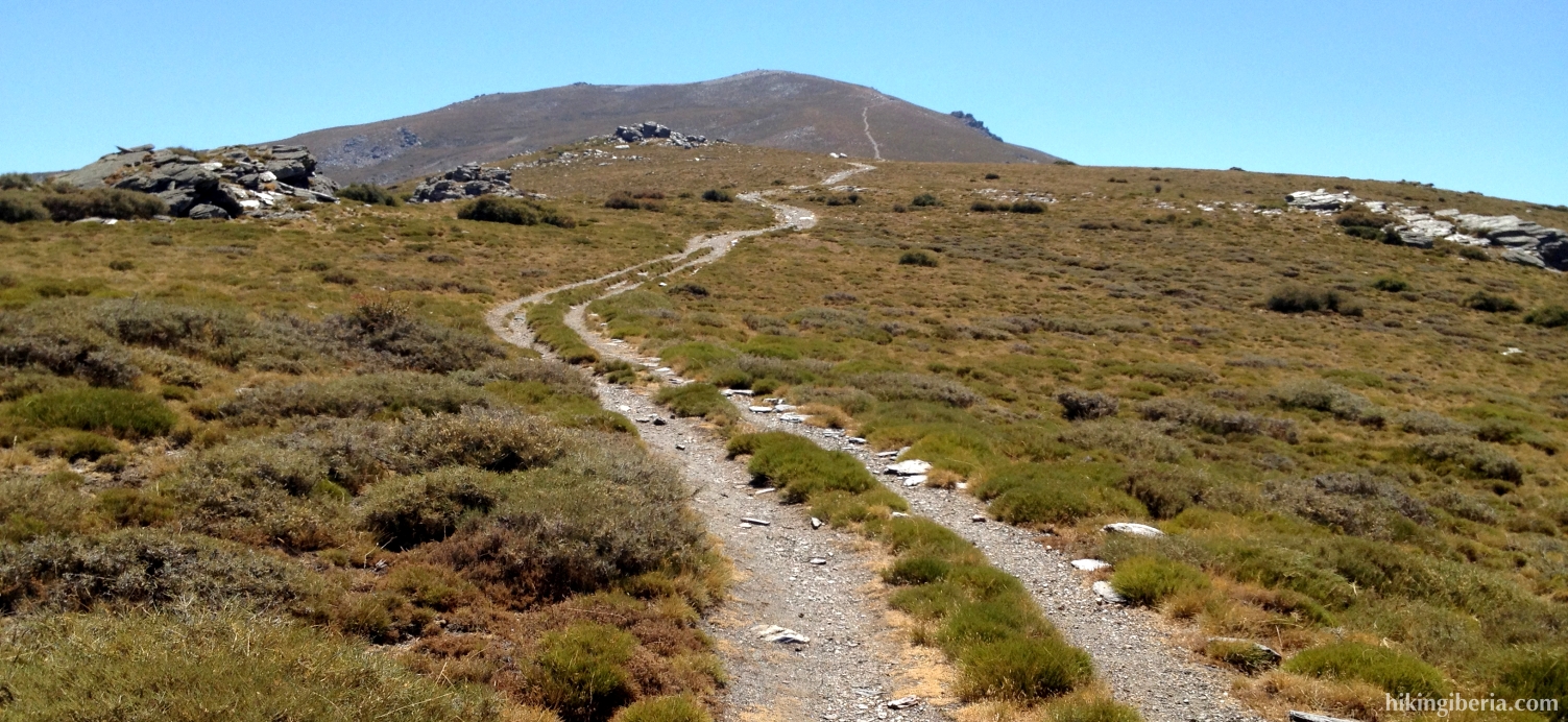
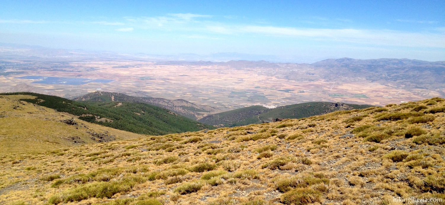
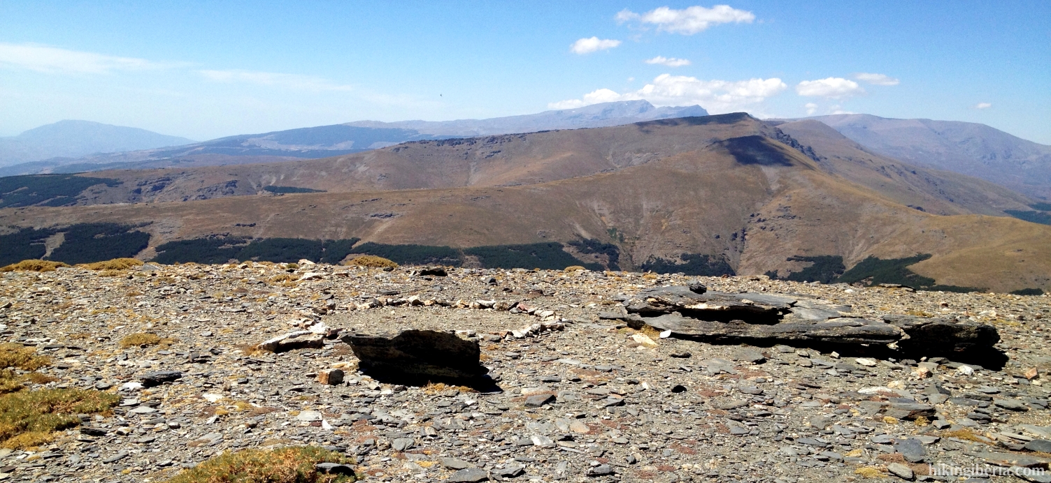
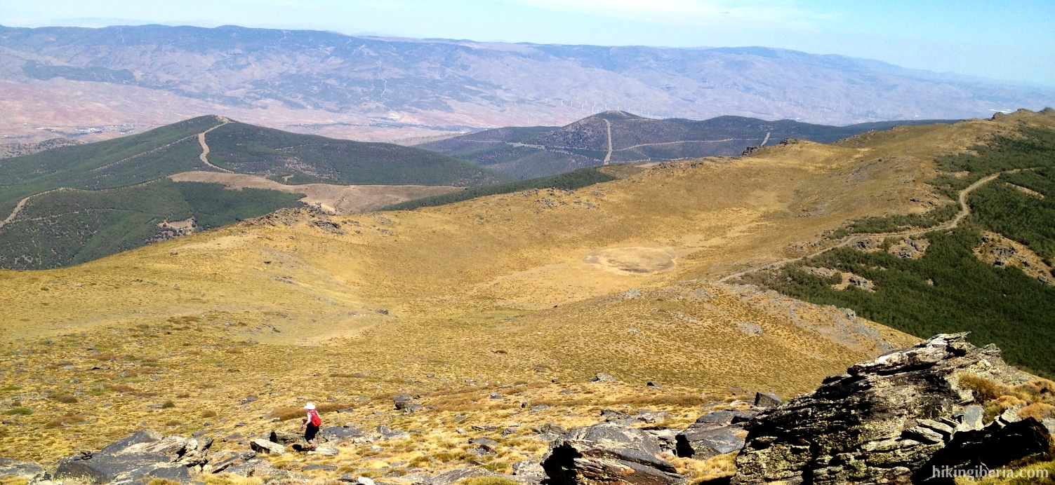
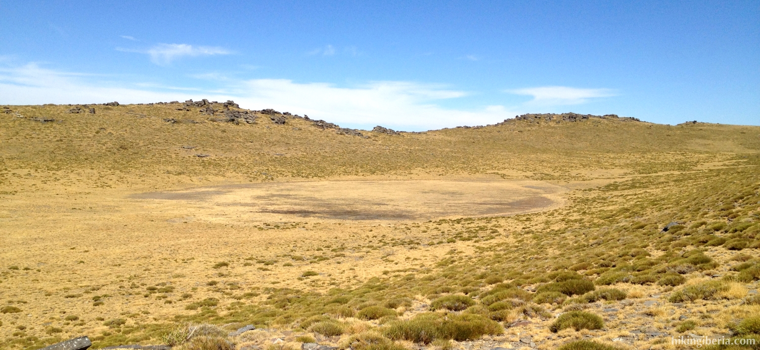
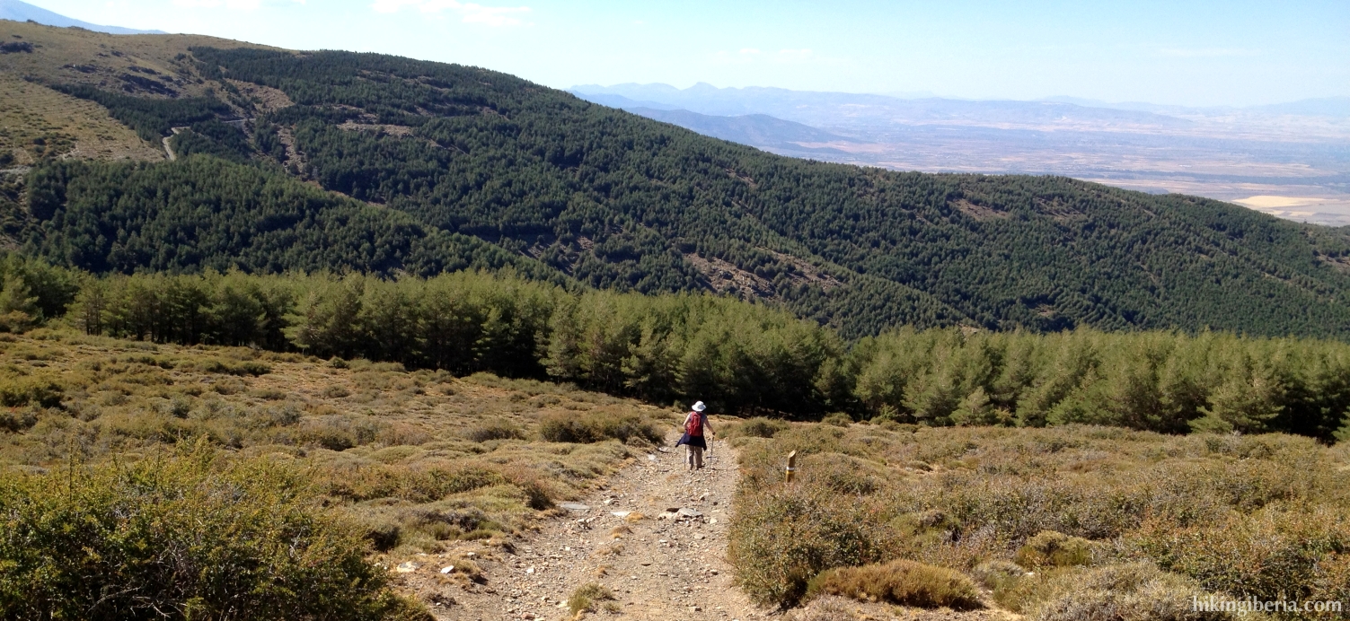
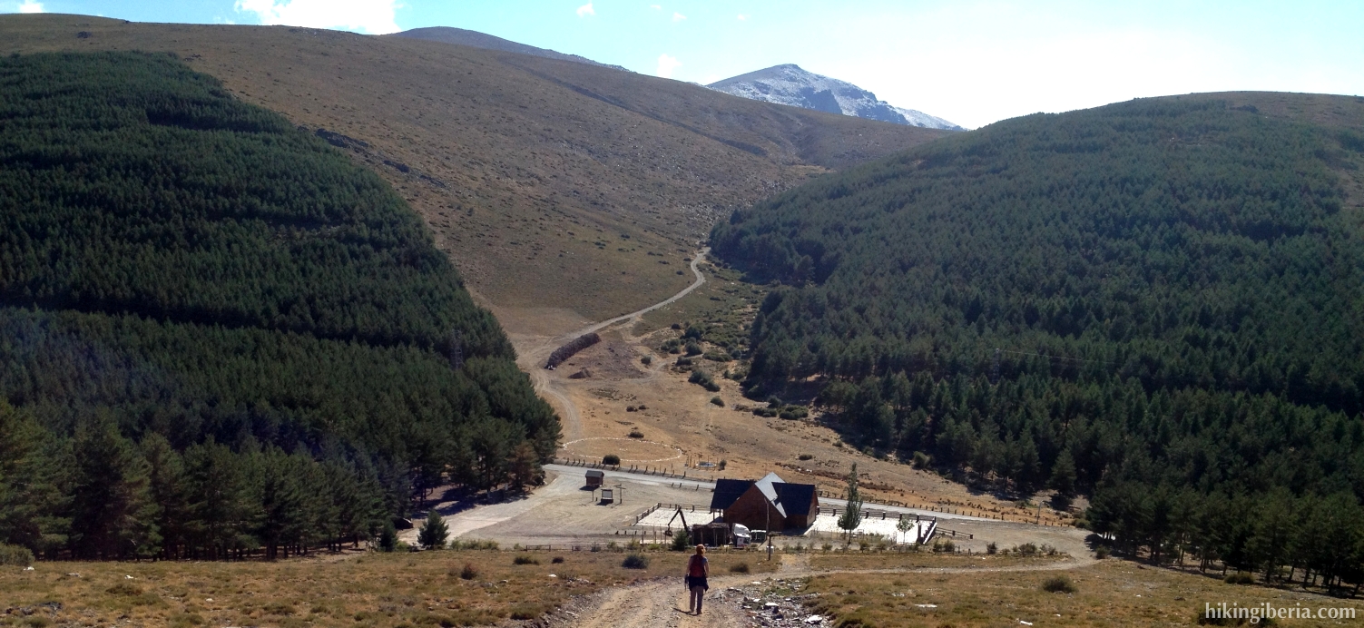
During this hike we climb El Chullo, with its 2,611 metres the highest peak of the province of Almería. The first part is a climbing of about 700 metres to this top, which is not difficult because of the good wide trails and the graduate ascent. From the summit of El Chullo on one side we have a beautiful view over the province of Almería, on the other side we can observe the considerably higher peaks of the Sierra Nevada in the province of Granada. After the summit the scenery becomes more interesting when we descend to the Laguna Seca (“Dry Lake”) – a lake that loses its water in summer - past remarkable rock formations. On the second part of the route we walk through comfortable trails back to the Puerto de la Ragua.
- From the Puerto de la Ragua (1), behind the inn “Refugio del Puerto”, departs a trail, which lies on the firebreak and which directly runs steeply uphill. At the top of this trail we get past some pine trees with a trail on the right (2), which we ignore. A bit further on we keep following the trail on which we walk, which turns to the right (3).
- The landscape now opens itself in front of us and we can clearly observe the Chullo in front of us. We ignore a trail on the right (4) and at the next junction (5) we go right/straight on. At the next Y-junction (6) we also turn right, onto the trail towards El Chullo, which we eventually reach after climbing approximately 400 metres.
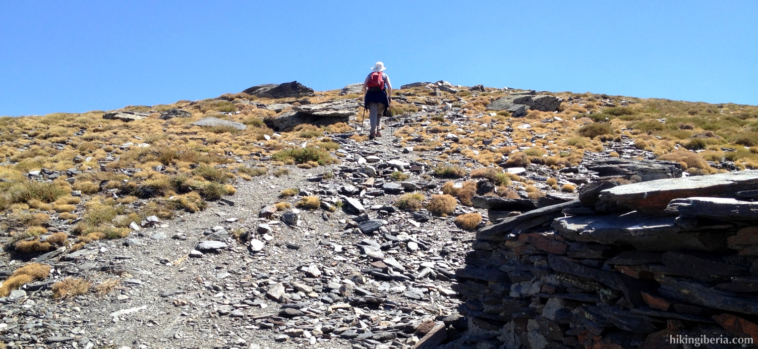
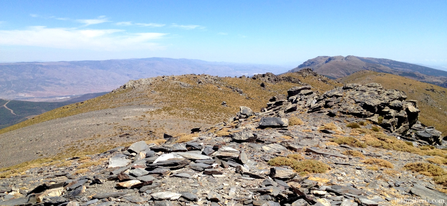
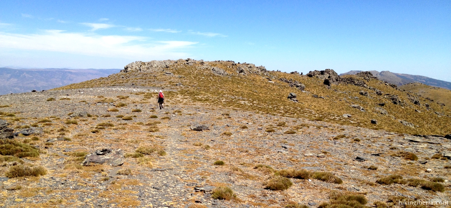
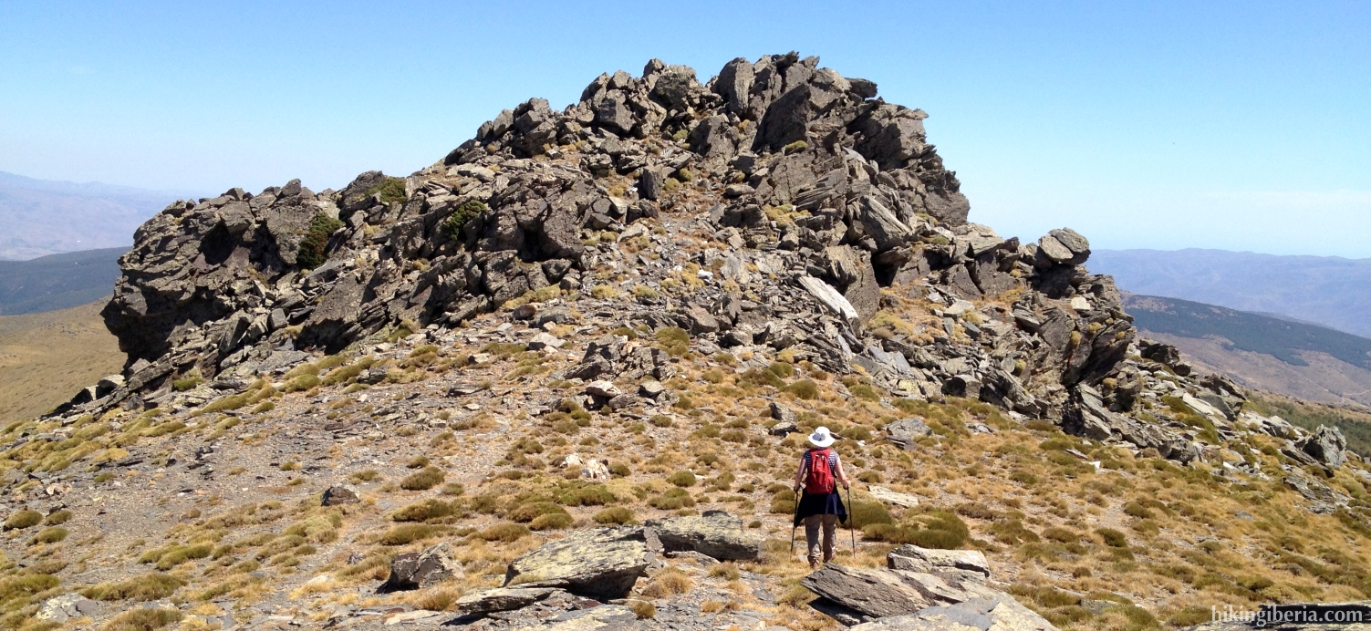
- From the summit of El Chullo (7) the trail towards the Laguna Seca continues straight on, by maintaining us slightly to the left (NE) from the summit. We now follow all the time the trail over the crest through a spectacular landscape of rocks. We ignore a trail on the right (8) towards the valley.
- We further follow the trail over the crest until a big formation of rocks. Behind it there is a signpost with an arrow (9), which directs us downhill on the slope, with in front of us a view on the Laguna Seca. This trail is marked with milestones.
- A bit further on (10) we need to keep a bit more to the right, back towards the crest. We follow the crest until an aiguille (11), from where we go downhill to the left, in a slanting direction, cruising clearly towards the Laguna Seca, towards the bend of the road that we see below in front of us.
- Near to the Laguna Seca (12) we turn left, onto a clearly visible trail uphill. At the top of this path (13) we turn left, which is indicated with a white-yellow marking and a signpost “Puerto de la Ragua”.
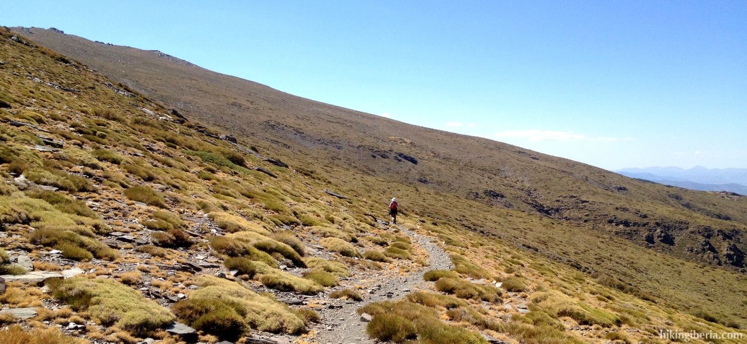
- We now stay for quite some time on this comfortable trail, which is marked white-yellow and with milestones. Much further on, where we see a small building on the right, we have to turn to the right leaving the trail through the open field, through a trail that is marked with wooden posts (white-yellow) (14). At the end of this trail, with a view on the valley on the other side, we reach a dirt road (15), where we turn left.
- We now descend through this road. There where the roads turns to the right with a bend (16), we turn left, leaving the road. We first walk a stretch parallel to the line of trees, then cross the trees through a narrow trail and eventually get at a dirt road (17), where we turn left.
- We follow this road, marked white-red-yellow, for quite some time until we cross another path (18). Here we go straight onto a narrower trail, still marked white-red-yellow. This trail brings us back to the trail of the way out (3), where we turn right and walk the last stretch back to the Puerto de la Ragua (1) via the same route.