NL
NL  IT
IT  DE
DE  ES
ES  EN
EN 
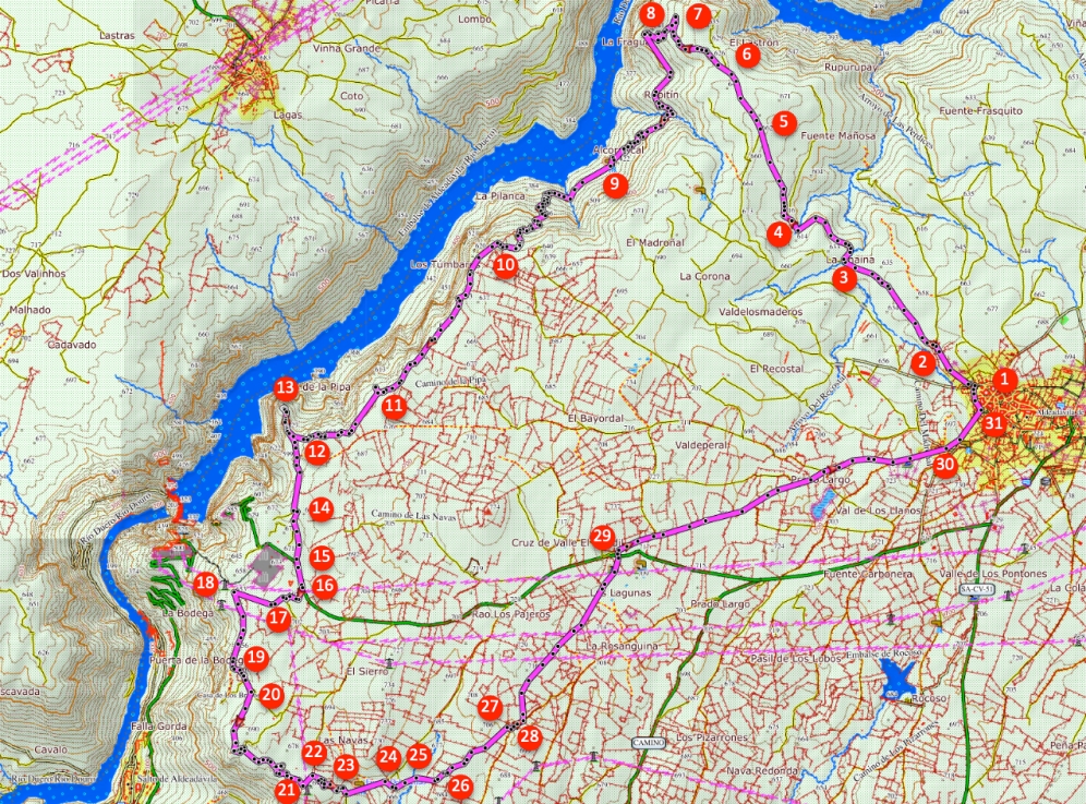
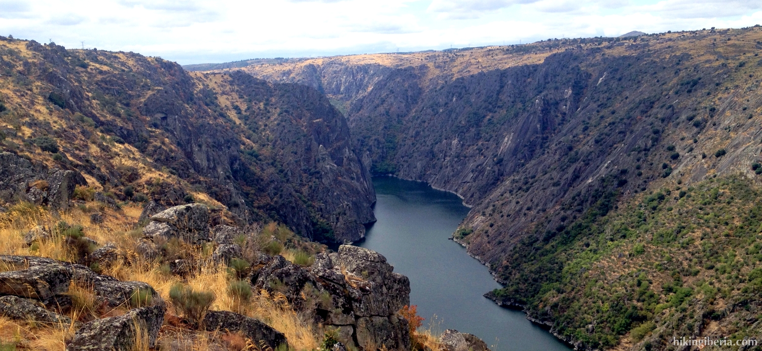
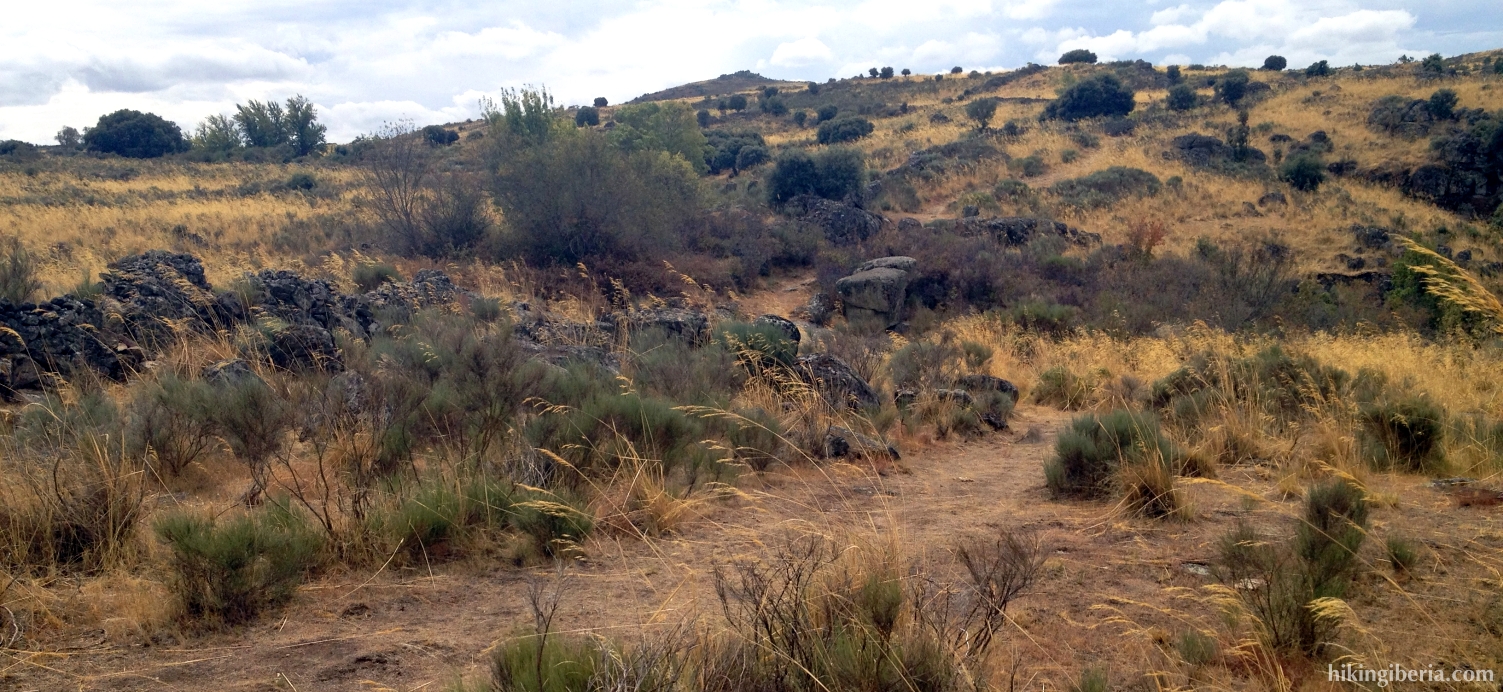
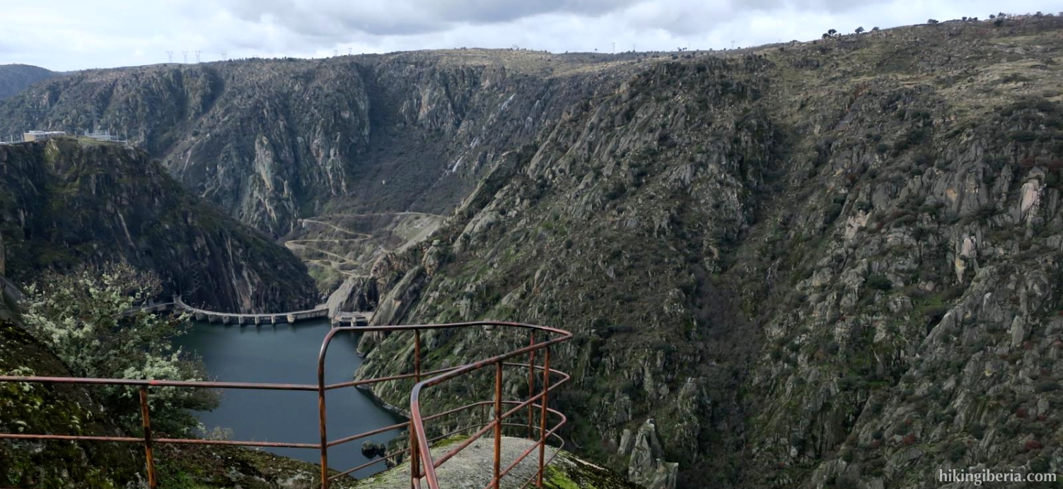
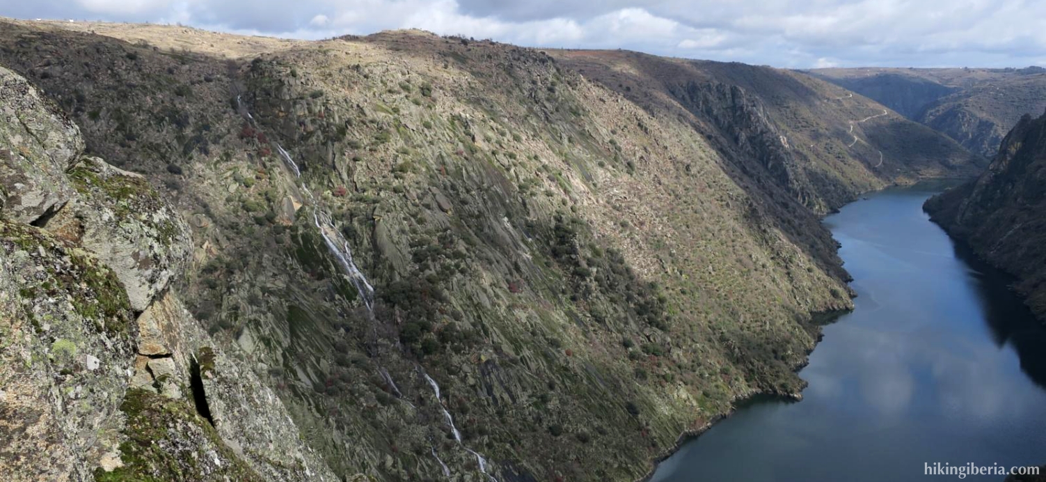
This hike in the surroundings of Aldeadávila de la Ribera gives a nice overview of what to expect when walking in the Arribes del Duero. In the first part of the hike we walk to the River Duero and all the time we have a marvelous view over the river, particularly from the Mirador of Rupitín and the Picón de Felipe. On the second part of the hike we walk past the hydro-electric power station through the flat empty landscape back to Aldeadávila. Part of this route is pretty overgrown, especially in summer, which makes both the walking and the orientation more difficult.

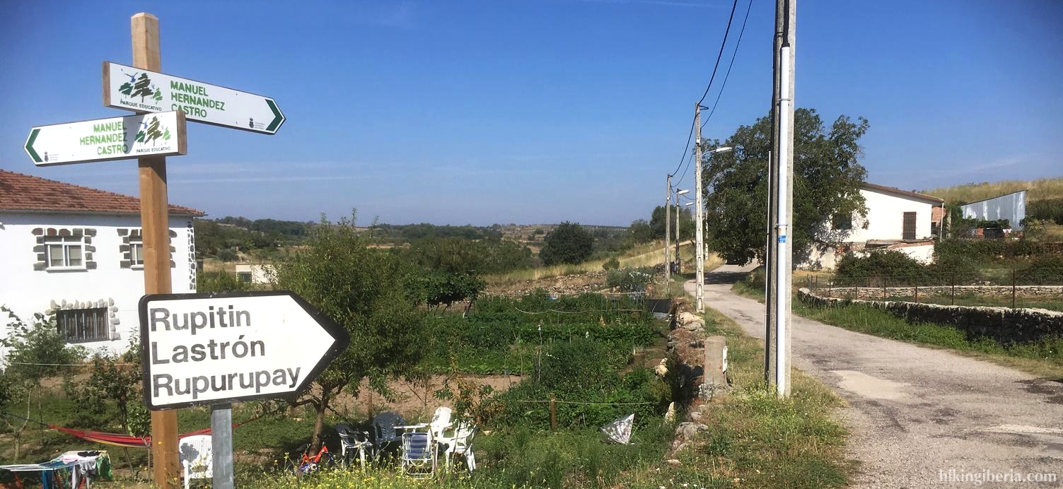

- We walk past the Ermita de la Santa (1) further down the Calle Abajo where we keep right at the first fork, in the direction of the sign Rupitín / Lastrón / Rupurupay. We follow this dirt road for a while and turn left on the next junction, in the direction of the sign to Rupitín (2).
- We ignore a path on the right and now follow the green-white marking of the Camino de Rupitín. A bit further at a Y-junction we turn right (3), in the direction of the sign Rupitín. Further on we ignore a path that goes down steeply to the right (4).
- Further on we cross a wide path where we go straight ahead, still in the direction of Rupitín (5) and we follow the green-white marking. Then we ignore a trail on the right and then on the left, start to descend a bit and reach a Y-junction (6) where we keep left, still towards Rupitín.
- Further on, just below 600 metres, the wide path ends and turns into a narrower trail. At a small fork we turn left (7) and ascend a bit. After a few bends the path splits and we go right, downhill, at a white-black signpost (8).
- We follow this narrow path for some time, which most of the time descends. Just over 400 metres the path forks and we keep left, uphill (9). From this point we ascend again. Just above 600 metres we reach another path next to a wall, where we keep right (19), at a white-green signpost.
- A bit further on at the right we see a trail to a big aiguille, where we have a nice view, so it is definitely worth the effort to walk to it (11).
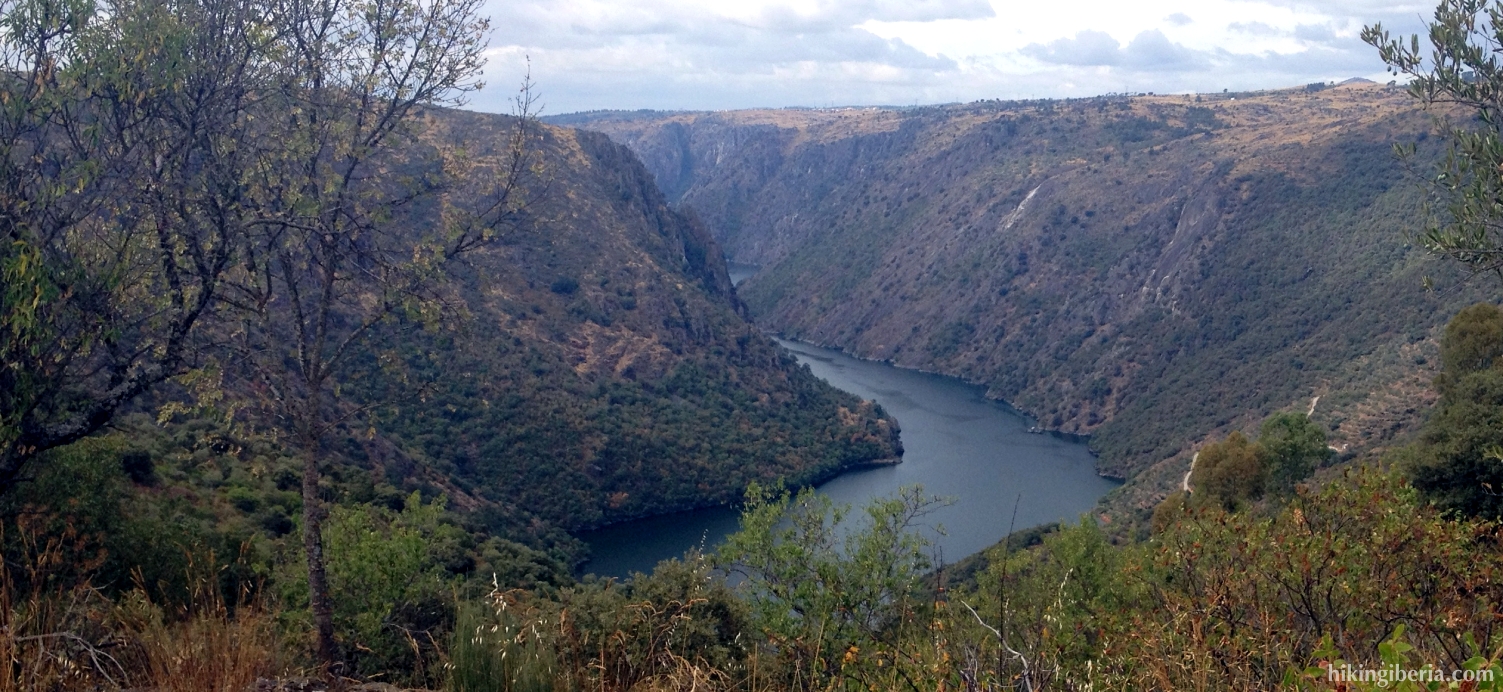
- We continue the path until we can turn right (12). Through this trail we descend to the Picón de Felipe (13), an aiguille with wonderful views over the Douro and the dam Aldeadávila. From the Picón de Felipe we walk back to the path and now turn right (12).
- Just before we arrive at a car park we take the bend to the left (14). Then we turn left on the dirt road. A bit further we arrive at an asphalt road where we go left again (15).
- We first see a path at the right that seems to go to the hydro-electric power plant and which we ignore. We turn right at the following path (16), at the white-green marking. A little further on at the Y-junction (17) we keep right.
- A bit further on at a number of large boulders, where right in front of us we see an electricity pylon, lies to the left a not very clearly visible path into which we turn (18), which makes us leave the white-green marking. We now walk for a long time parallel to a wall, until we come near an abandoned building and start to move away a bit from the wall, up the hill. Near this building we first go left (19) and then right (20).
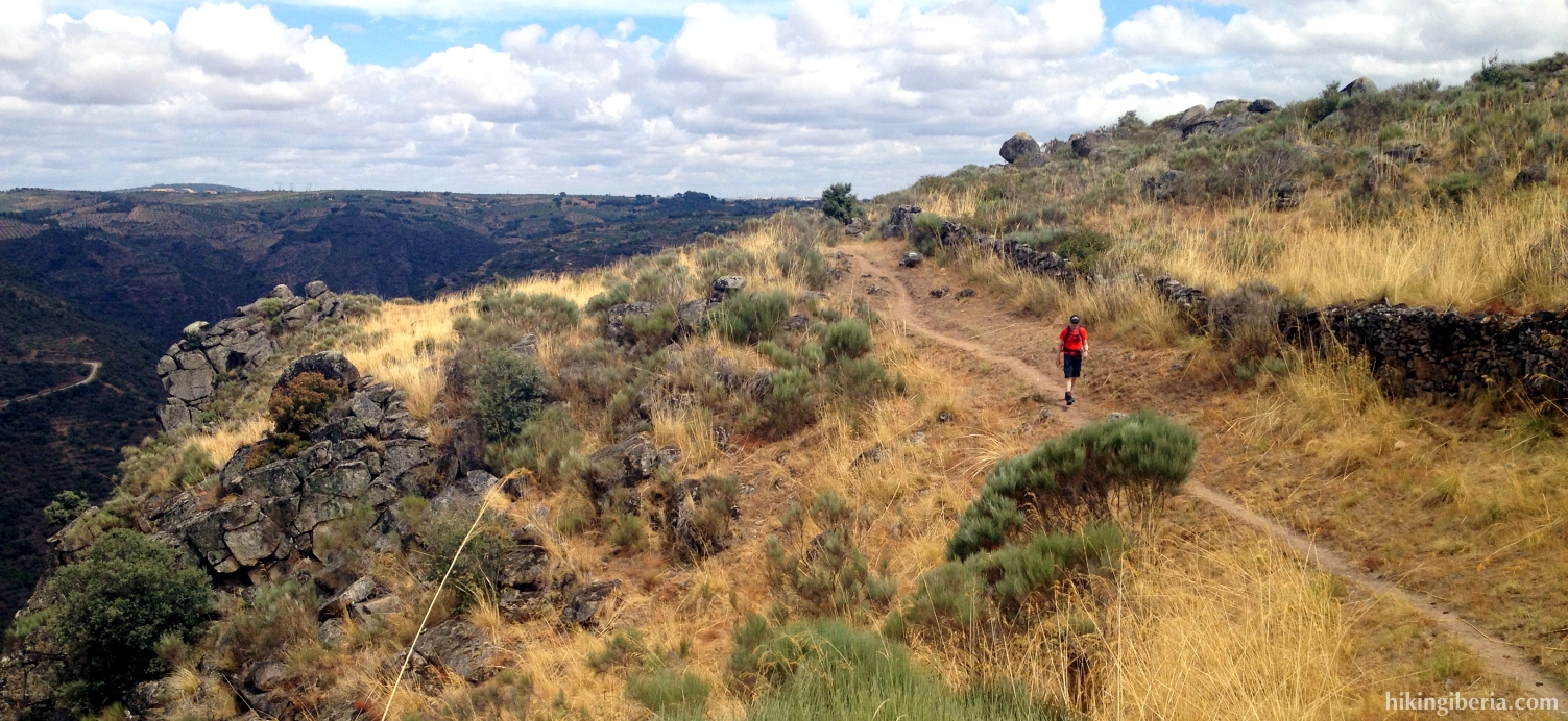
- The path is sometimes difficult to follow and overgrown; keep on heading south, more or less parallel to the Duero. In this way we pass some small peaks with posts. Further on we walk more towards the southeast and at a certain moment see an electricity pylon in front of us. Next to this pylon terminates a wide path where we turn left (21) and further on we turn right at a fenced off area (22). Follow here as much as possible the course of the fence downhill.
- Here we again have to search for the trails, but eventually we reach a wide comfortable path, the GR-14, where we turn left (23).
- From here we follow the white-red marking of the GR-14, and thus a little further on turn right (24), leaving the wide path. We reach a wide path where we turn left and then immediately right onto another path (25). A little further at a crossroads we follow the white-red marking to the left (26).
- Further on the path ends at a wall and we see a fence at the right. We continue here our way to the left (27) at the signpost to "Aldeadávila 4.6 km". A little further on we leave this road to go left, onto another dirt road (28).
- This road we follow all the way to the end and ignore some side trails and reach an asphalt road, which we cross (29). Behind the wall we turn right, still following the white-red marking. This way we now follow all the time straight ahead and ignore several side paths.
- So we finally walk towards Aldeadávila, where we follow the bend to the left (30). Further on we turn left, into the Calle Berzal (31).