NL
NL  IT
IT  DE
DE  ES
ES  EN
EN 
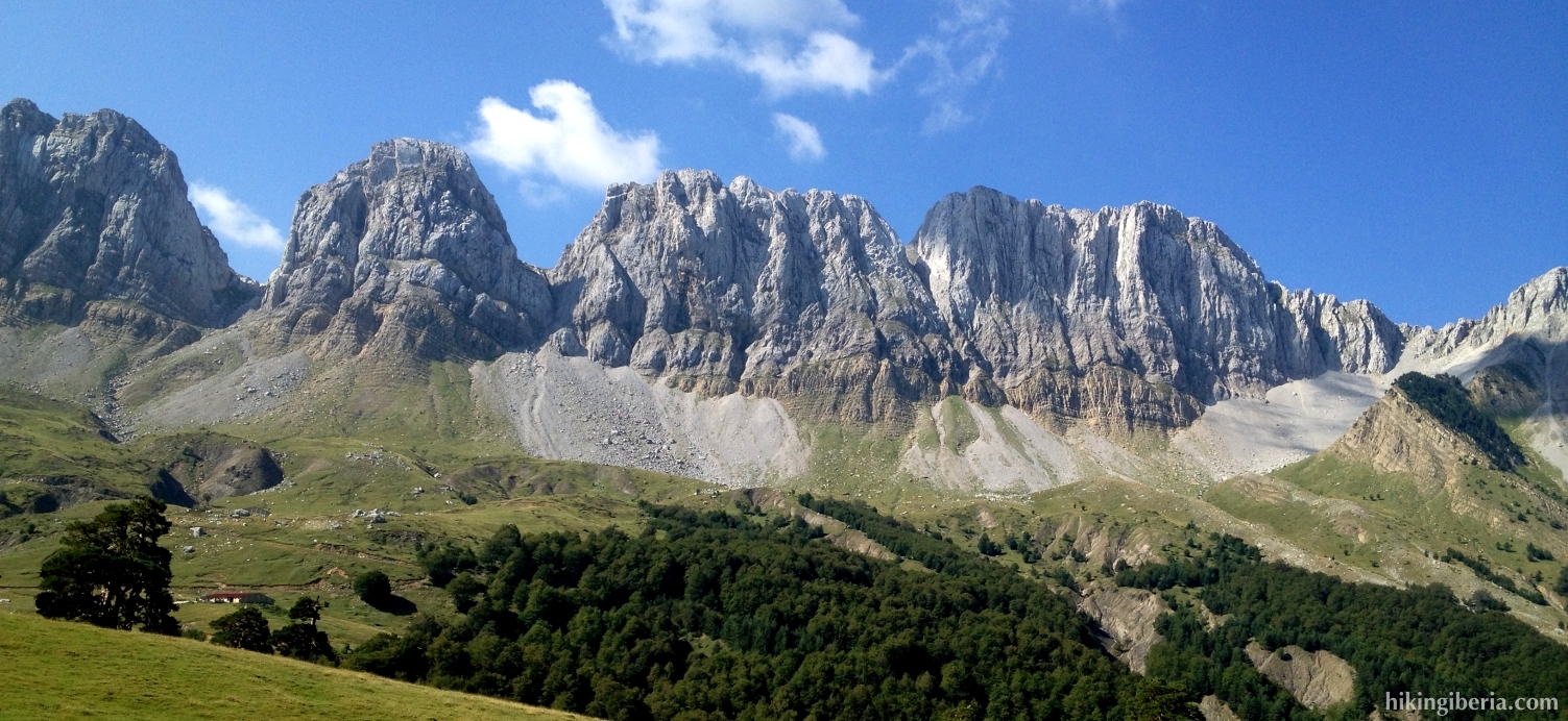
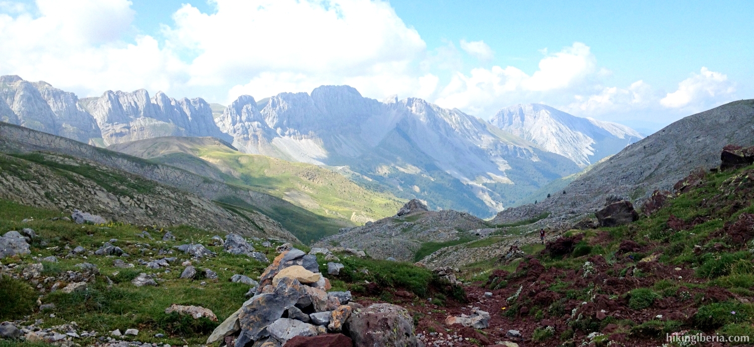
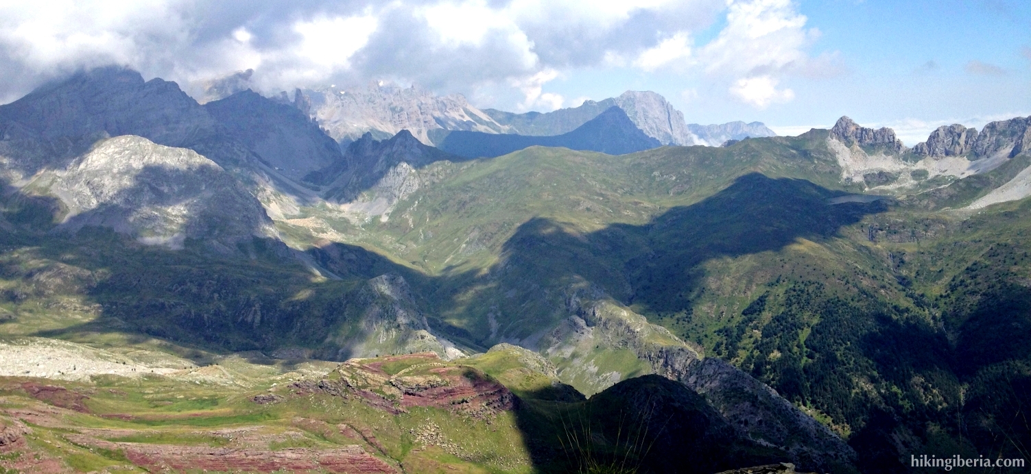
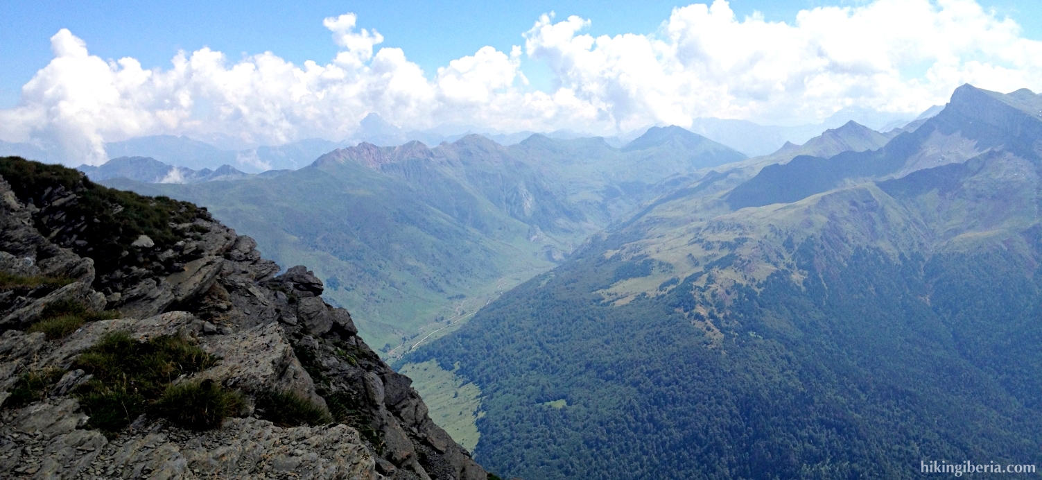
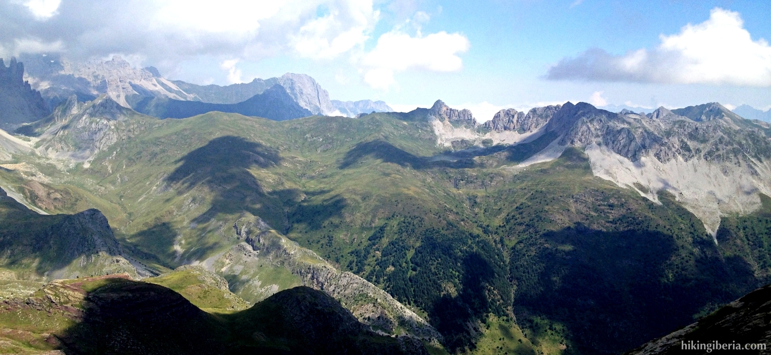
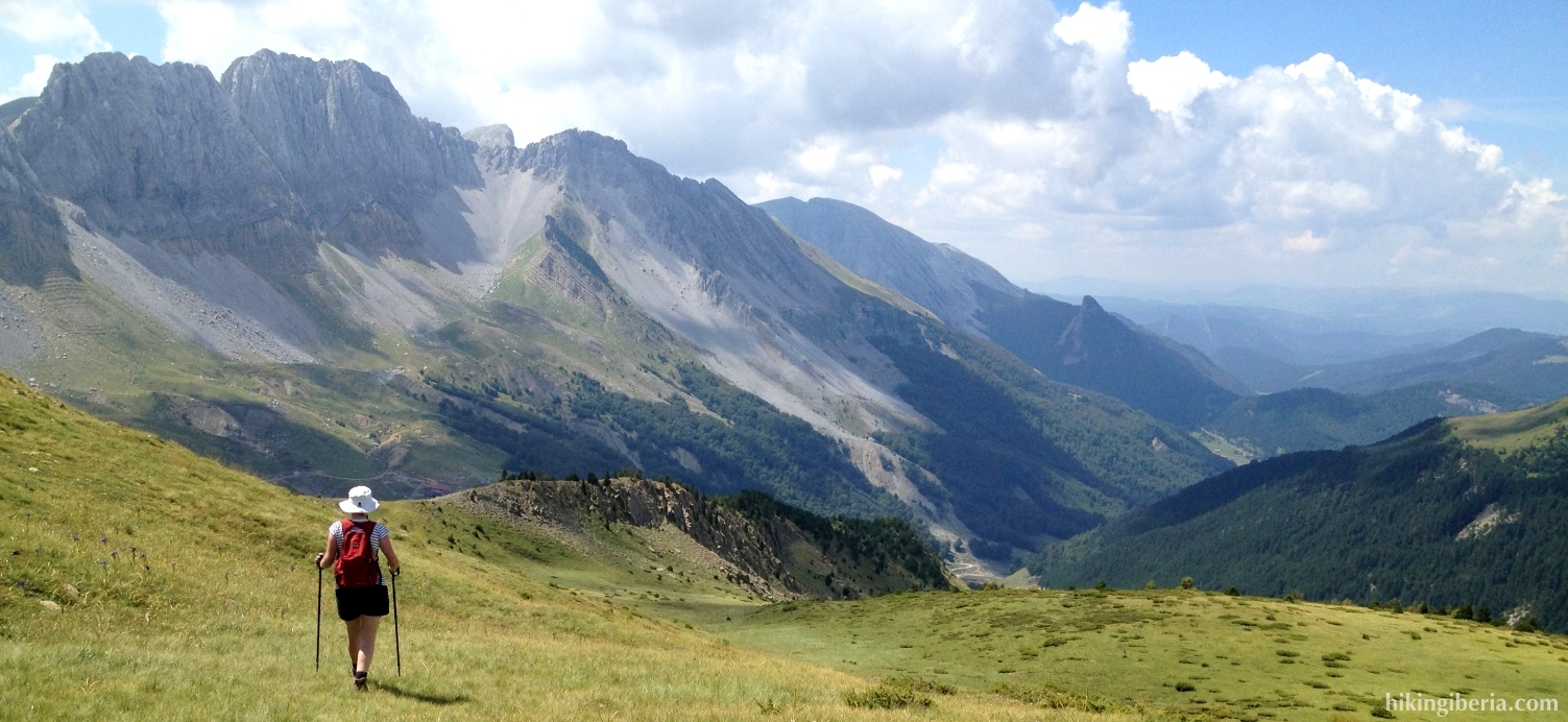
The Chipeta Alto is a peak of 2,189 metres altitude that lies at the corner of a spectacular massif and can be reached astonishingly easily. Near this top lies a big flat field (La Planada) through which we can reach this top without too much effort. From this peak we have a very very wide view over the Pyrenees of Navarre, Aragón and France. During the last part of the hike past the Chipeta Bajo we descend through a gorge, which complicates the hike a bit. We can keep the hike easier though by earlier - close to the Chipeta Bajo - taking a trail back to the Barranco de Petrachifa.


- From the parking lot (1) do not cross the bridge but walk back to the beginning of the parking lot to the road from where we arrived by car. Here lies a trail signposted as the white-red marked GR-11 (2).
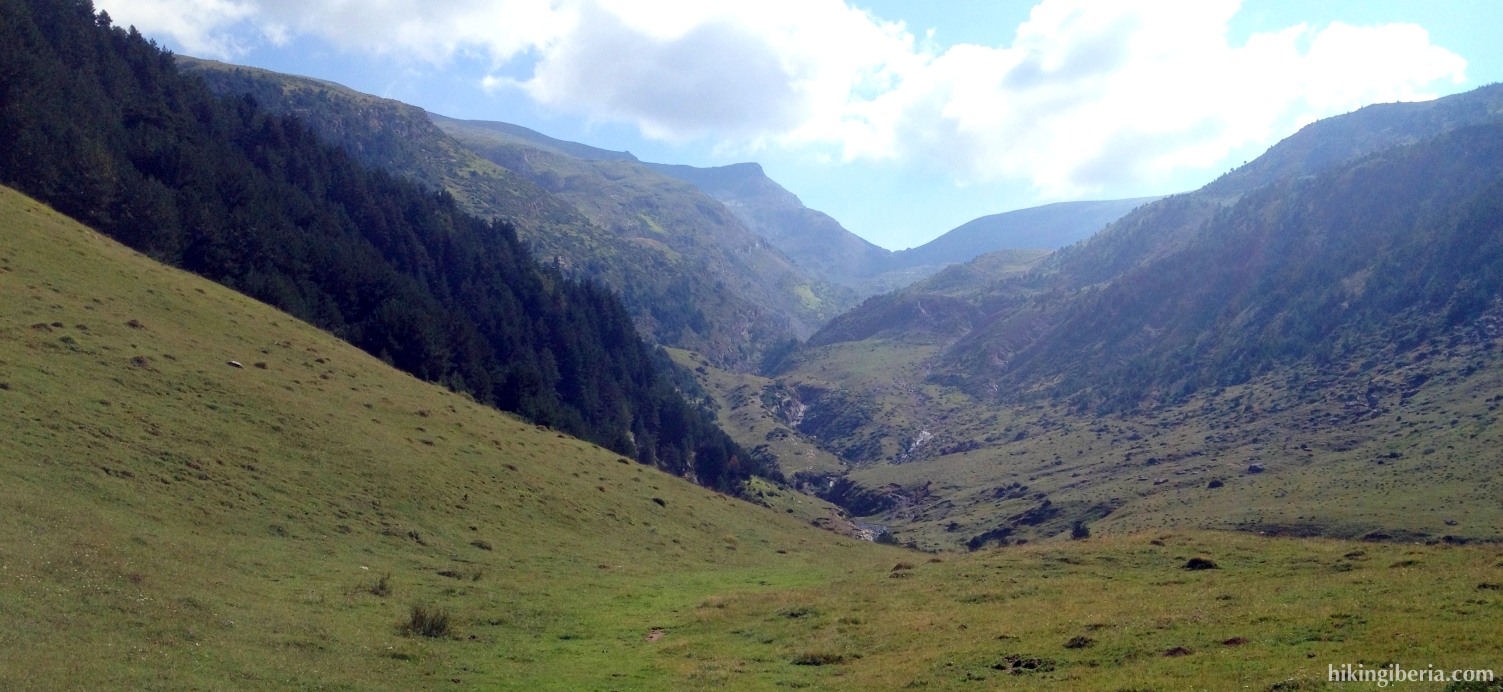
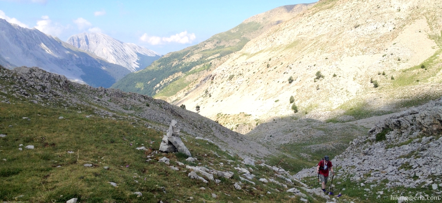
- This trail leads us past the refuge of Tacheras (3). Here we continue straight on over a green pasture. Further on we can see the trail originate again, at the left side of the valley.
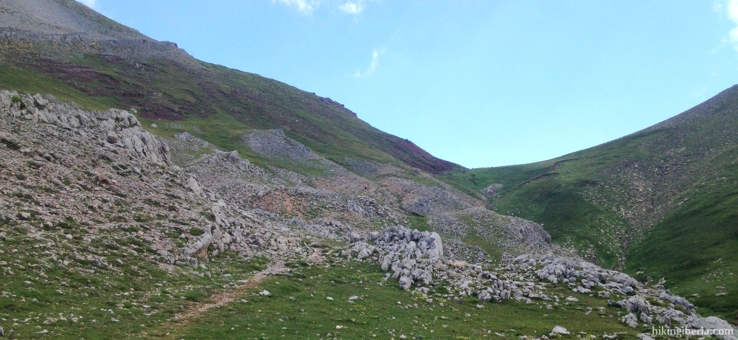
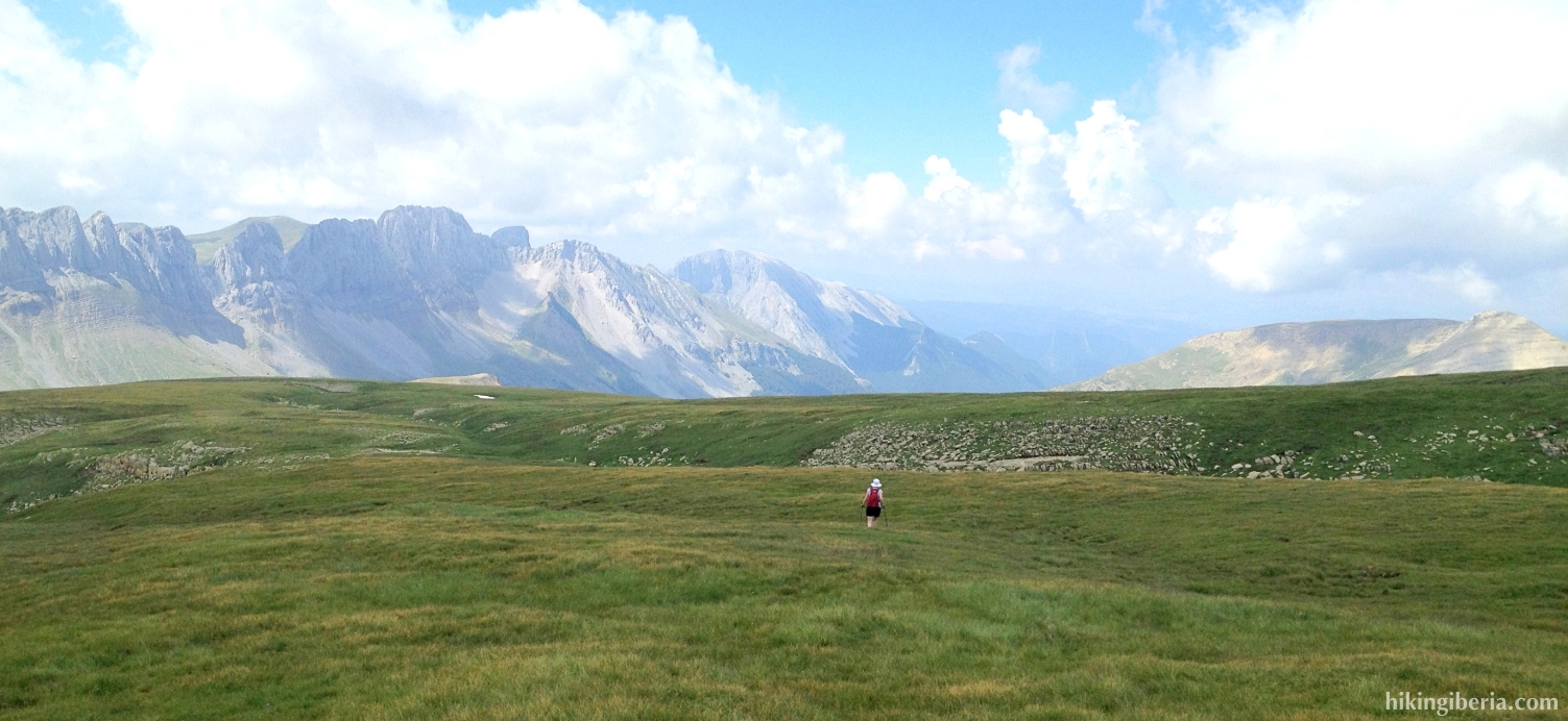
- We follow this path quite a while until the pass Collado de Petrachifa (4). Here we now go right onto a narrow trail. At a certain moment this trail disappears and we reach an open green slope (5). Keep left here and walk towards the highest point of this slope (6).
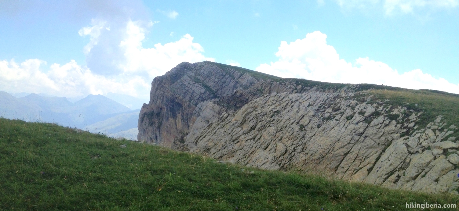
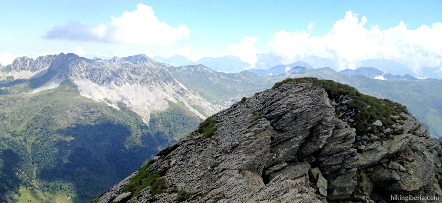
- At the highest point we can now see at our right an amazing aiguille: the Chipeta Alto (7). Thus we walk to it.
- From the Chipeta Alto (7) we walk back over the crest. Below this crest (8) we now do not turn right (which would be into the direction from where we came) and neither go too much to the left. Walk, as much as possible, straight on through the middle of the field. After we have crossed this field we reach a trail that runs to the left.
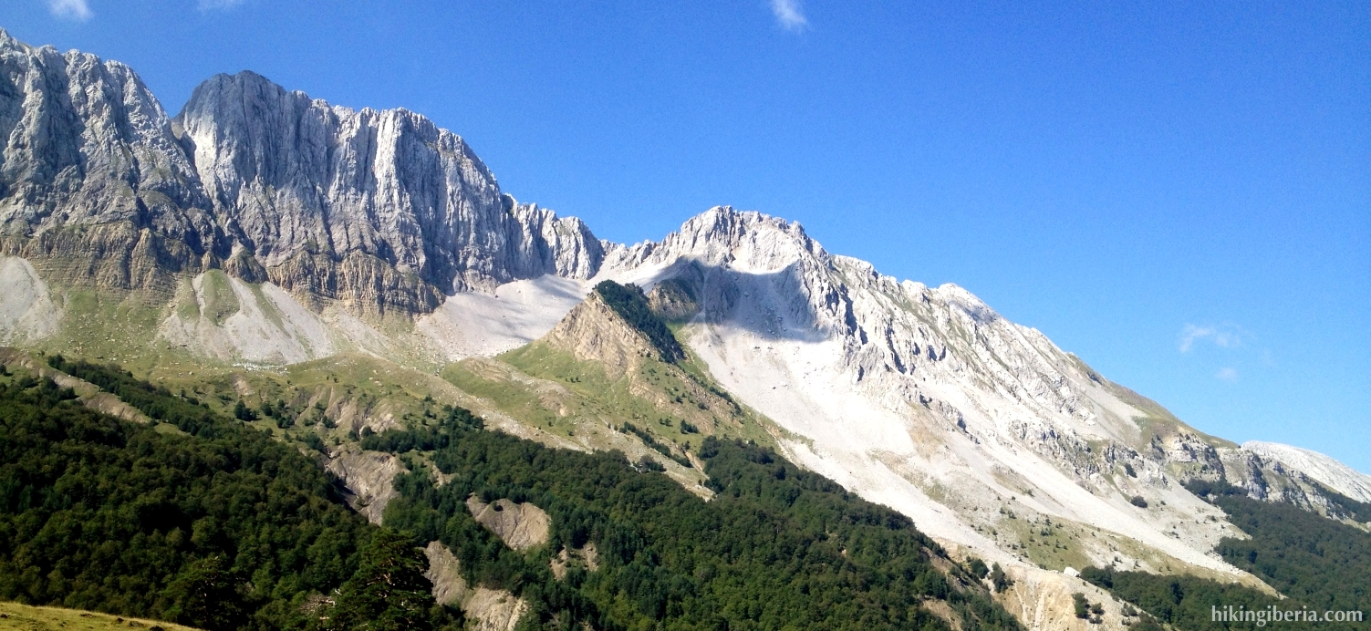
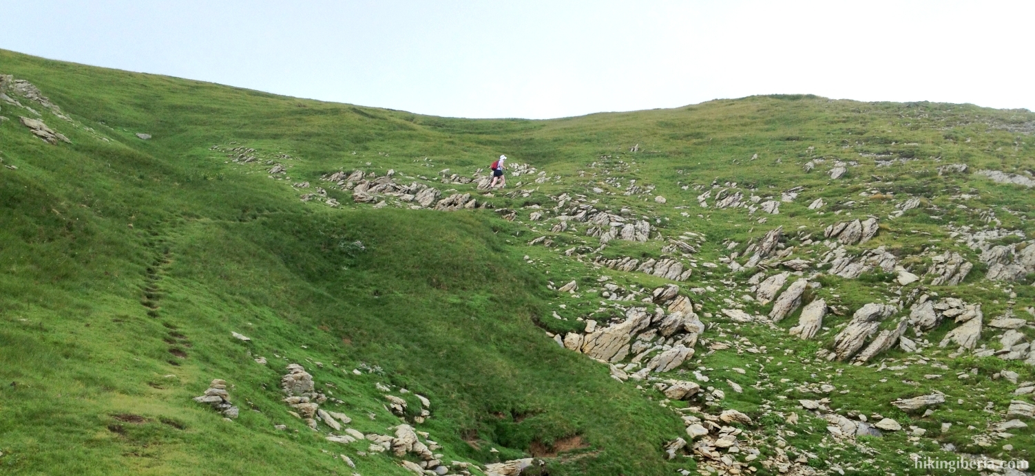
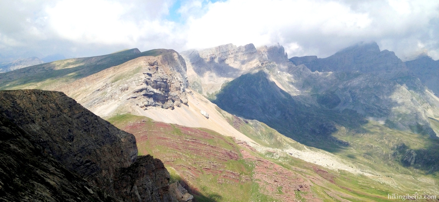
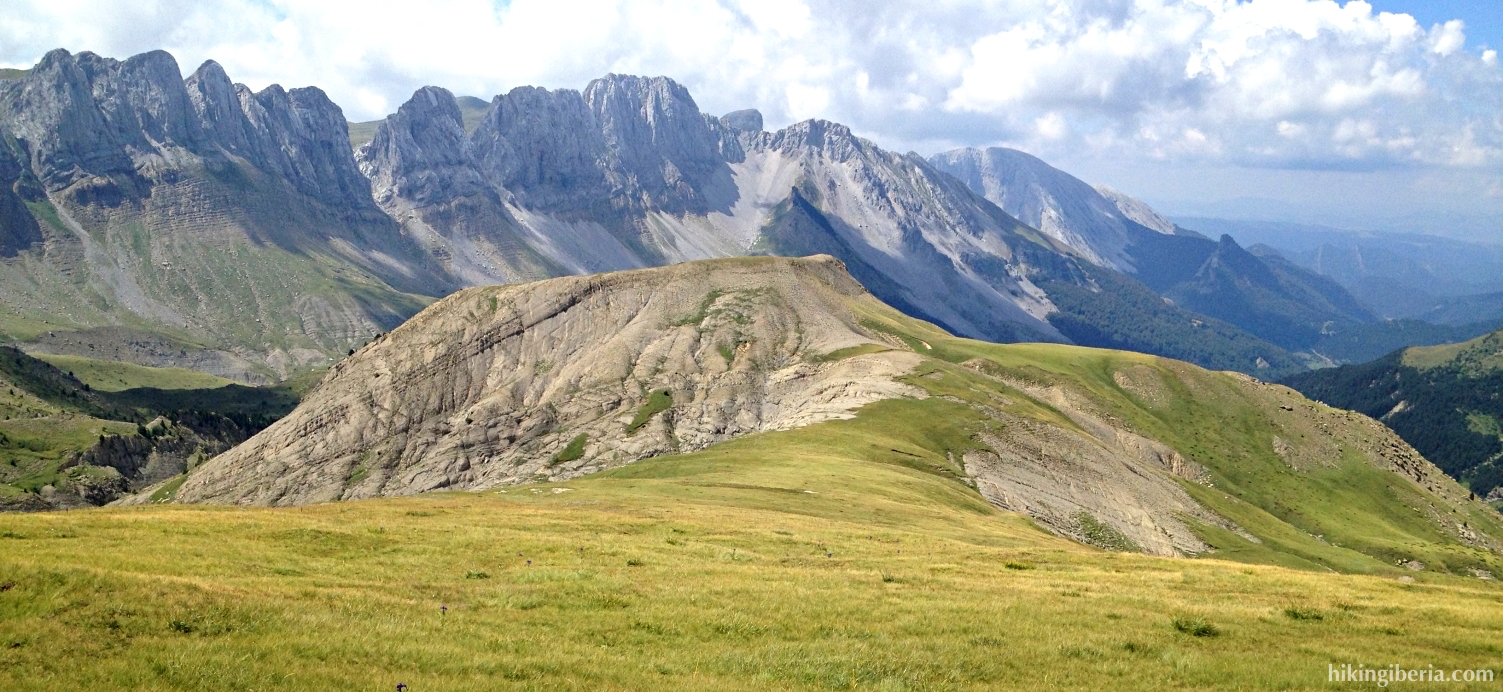
- At a certain moment this trail is not very well visible any longer. Take care to keep as much as possible to the right, walking towards the side of this crest. In this way we reach an open field and we see a peak in front of us: the Chipeta Bajo (9). To keep the hike easier, we can now take a trail here on the right to the Barranco de Petrachifa, but our route continues straight on.
- We maintain the Chipeta Bajo as orientation. We walk over a col (Collado Chipeta) just before this peak. When we have this peak on our left hand we turn to the left and then to the right (10). We now cross a field of grass and at the end of this field keep left (11) and start to descend.
- We now descend into the valley, with straight in front of us clearly visible the refuge of Tacheras. The trail sometimes is hardly visible. When the trail disappears completely we keep right (12) and follow as much as possible the course of the gorge. The orientation can be complicated here, but just keep as orientation the Barranco de Petrachifa, the gorge through which we walked on the way out.
- Once below in the Barranco de Petrachifa (13) still before the stream turn left onto a narrow trail. Further on we cross the water (14). Still further on we reach the trail on which we already walked on the way out and now turn left (15).
- We now climb a stretch until the Refugio de Tacheras (3) and walk back to the parking lot (1) via the same route.